 宮古島アプリの綾道(あやんつ)トップページ
 宮古島アプリの綾道(あやんつ)の内容
 宮古島の3つのルート
 宮古島市長のあいさつ
 宮古島文化遺産紹介
【Designated by the City:Natural Monument and Historic Sites】Sazuga-Mine Ridge Volcanic Tuff Stratum and Sazuga Underground Bunker
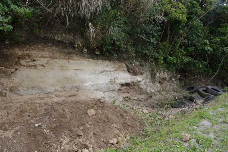
The strata distributed in Sazuga-Mine Ridge correspond to the Shimajiri Group, which is the bedrock in the southern region of Okinawa Prefecture. In the designated area, two volcanic tuff layers can be confirmed in the Shimajiri Group. In addition, the volcanic tuff strata show upward moving tuffaceous sandstone, as well as mudstone and sedimentary changes. From these observations, we can infer the paleoenvironment at the time of strata formation.
The presence of the volcanic tuff strata offers evidence that submarine volcanic activity was involved in the formation of Miyako Island. Furthermore, unconformities between the Shimajiri Group and the Ryukyu Limestone Layer, as well as faults and other geological structures that have been confirmed in the designated area, provide a valuable resource in understanding the origins of our island and region.
Additionally, a bunker (Sazuga Underground Bunker) was dug in a U-shape in the Shimajiri Group during the Pacific War, which remains today as a war ruin. During the war, many pits and bunkers were dug throughout Miyako Island and this bunker is one of them.
≫View on a Google Map