 宮古島アプリの綾道(あやんつ)トップページ
 宮古島アプリの綾道(あやんつ)の内容
 宮古島の3つのルート
 宮古島市長のあいさつ
 宮古島文化遺産紹介
【National Designation:Place of Scenic Beauty/Natural Monument (Geological Feature)】Tooriike Ponds of Shimoji Island
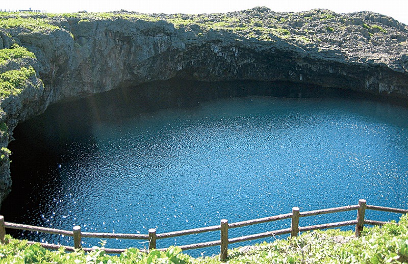
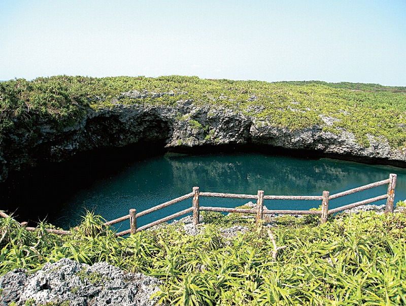
Toorike are two ponds connected by a natural bridge. The northeastern side is approximately 55m in diameter and the water depth is about 25m. The southwestern pond is approximately 75m in diameter and the depth of the water on the side closer to the ocean is approximately 40m. An underwater cavern that is about 10m in diameter connects the ponds to the ocean and their depths change according to the ebb and flow of the tide. The ponds were created as stalactite caves formed over a long period of time in the Ryukyu limestone, which connected to the ocean, and two areas of the cave fell and formed a natural bridge.
This Tooriike is said to be a subsidence doline, connecting to an underwater sea cave. Besides this location, Shimoji Island has other doline geological features which remain from the formative period of abrasion shelves, like the Nagabidaiki, Ganaiki, Okoiki, and Pasamaiki, which are valuable in the fields of geology and geomorphology. There are several legends related to the twin ponds. One tale tells of fishermen who caught a spirit of the seas, and to punish them, the seas attacked with a tsunami, destroying the fishermen’s homes and the ponds were created where their houses once stood. Another legend speaks of a person who mistakenly pushes their own child into the pond, thinking that the child was their stepchild. The Tooriike is known for its spectacular view. With the mystic blue seawater, its beauty is a rare sight even within the nation. The location also teaches us the splendor of nature, with the karst features unique to limestone geology, and the coastal vegetation communities that adapt well with the environment.
≫View on a Google Map