 宮古島アプリの綾道(あやんつ)トップページ
 宮古島アプリの綾道(あやんつ)の内容
 宮古島の3つのルート
 宮古島市長のあいさつ
 宮古島文化遺産紹介
【Designated by the City:Natural Monument (Sanctuary)】Vegetation on the Cliff of Kurima Island
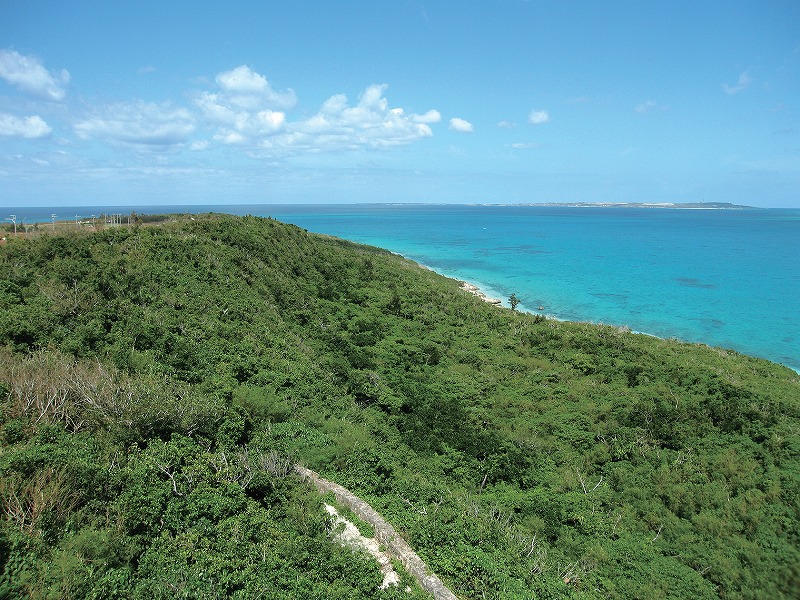
This fault escarpment is located at the north shore of Kurima Island. The ridgeline of the cliff is approximately 100 m in width from the coast and parallels the shoreline. The fault is approximately 2.4 km in length and connects to an 850 m abrasion cliff, which makes the total length 3.2 km and surrounds the half of the island.
It is one of the fault edge lines that characterize the Miyako Islands, and considered to have been formed during the Quaternary Pleistocene. The soil is Ryukyu limestone. The landscape is rich in variety including a sheer cliff and a steep slope with the highest point being approximately 45 m above sea level.
The vegetation in the vicinity can be categorized by topography: The sheer cliff is covered 75% by banyan trees, followed by sago palm, Goushutaniwatari, and Amami-hitotsubahagi in the order of appearance. On the slope side, the surface is covered by plant communities consisting of Indo-sharinbai, banyan tree, Tsugemodoki, Akatetsu, Tobera, Ryukyu-gaki, and in some places, Adan. At the shoulder of the cliff, there grow Sakishimaenoki, of which the distribution is unique. Fertile land with fallen gravel extends below the cliff. Kuroyona communities have been formed there, adding value to the neighboring vegetation. These communities have much developed with six-meter trees and 90% coverage on average.
≫View on a Google Map