 宮古島アプリの綾道(あやんつ)トップページ
 宮古島アプリの綾道(あやんつ)の内容
 宮古島の3つのルート
 宮古島市長のあいさつ
 宮古島文化遺産紹介
【Designated by the City:Monument (Place of Scenic Beauty)】Shiratorisaki Reef Coastal Area
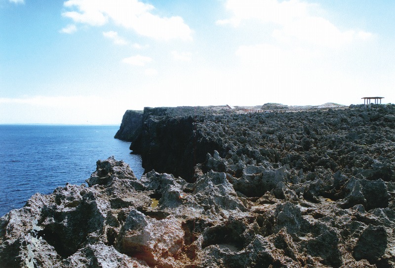
Located at the northwest of Irabu Island and facing the East China Sea, this is a shore reef area created by the ocean that holds an arc-shaped fringing reef (commonly known as Shiratori Higata (mudflats)), and its encroachment. It is currently a part of the west coast park area with abundant vegetation of rocky plants that are unique to the subtropics.
Irabu and Shimoji Islands consist of the Shimajiri Group formed during the Pleiocene era, about two to six million years ago, covered by the Ryukyu limestone layer during the Pleistocene era.The Ryukyu limestone was created about two million years ago, and referred to as Tomori limestone, Shimoji Island limestone, and Shiratorizaki limestone.
The Tomori limestone, exposed in the surrounding area of Makiyama and Shiratorizaki, is a relatively old limestone among other types of Ryukyu limestone. An intricate limestone is also called Torapachin.Shiratorisaki has severely been weathered and encroached, and has partly formed fence-like structures. It is also a valuable site where layers during the Pliocene era are exposed.
≫View on a Google Map