 宮古島アプリの綾道(あやんつ)トップページ
 宮古島アプリの綾道(あやんつ)の内容
 宮古島の3つのルート
 宮古島市長のあいさつ
 宮古島文化遺産紹介
【Designated by the City:Historic Site】Harimizu Stone-Paved Road
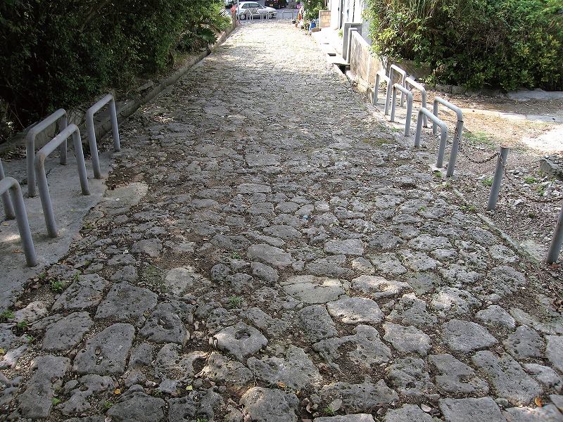
It is said that erosion control and engineering works were vigorously being conducted at the beginning of the 18th century, and the roads in each of the villages and settlements were being expanded to approximately 4.5m in width, improved, or newly laid. As part of the engineering work that took place after the Great Earthquake in 1696, the stone-paved roads were also being expanded to 4.5m, and it is thought that the rocks that were abundantly gained in the erosion control works were cut, and laid on the roads.
The stone-paved road extended trom the south side of the Kuramoto, the government office of the foremer feudal domain, reaching to the crossroads from the Harimizu Utaki sacred site to the northeast of Shounji Temple. The roads remained almost fully until after the abolishment of the feudal rule and when the prefecture was established. However, with the construction work of the Hirara Port (in 1921) the relocation of the Miyako Jinja Shrine (in 1942), and with World War II and the road construction and other works after the war, only about a third of the stone-paved roads remain today.
≫View on a Google Map